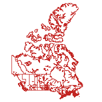
Boundary Files, 1911 Census of CanadaCoordinate system: 4269 - "NAD83" Abstract:This data set reconstructs the census compilation and dissemination geography of the 1911 Canadian Census at the census division (CD) and census subdivision (CSD) level of geography. The shapefiles (.shp) were derived from a comprehensive geodatabase, as part of the Canadian Century Research Infrastructure (CCRI). Detailed water polygons were replaced with a selection of major lakes in this version, indicated with the abbreviation MW in the file name, which stands for ‘major water’. These data are a part of a geographical framework constructed to enable the location, selection, aggregation, and analysis of census data, for census enumerations between 1911 and 1951. |
Additional Documentation
-
Metadata Information
Language: eng; CANLast Update: 2016-05-05Other Maintenance Requirements:Metadata was created using metadata provided by University of Alberta Libraries.Metadata Contact:Moldofsky, Byron, University of Toronto Toronto Ontario, CanadaContact Instructions:byron@geog.utoronto.caMetadata Standard:North American Profile of ISO 19115 Geographic Information Metadata -
Citation Information
SeriesName: Canadian Century Research Infrastructure
Canadian Century Research Infrastructure , CanadaAmrhein, Carl, University of Toronto Ontario, CanadaRichard, Laurent, Université Laval Quebec, CanadaMoldofsky, Byron, University of Toronto Ontario, CanadaBeaudry, Mariange, University of Toronto Ontario, CanadaSt-Hilaire, Marc, Université Laval Quebec, CanadaThemes or Categories of the Resource: boundariesKeywords:Boundaries, Society, Census Division, CD, Historic Census of Canada, CCRI, Canadian Century Research Infrastructure, Open Data, 1911, Geographic Data, Census Subdivision, TownshipBoundaries, Frontière, Census, Recensement, Census data, Données du recensementPlace Keywords:Continent > North America > CanadaPurpose:This shapefile was created by the Canadian Century Research Infrastructure (CCRI) project, and consists of boundary polygons that reconstruct the census compilation and dissemination geography of the 1911 Canadian Census at the census division (CD) and census subdivision (CSD) level of geography. It can be used on its own with the attribute data fields included in the file, or it can be joined to other tabular data based on a linking field and a unique identifier (CCRIUID).Dataset Language:Status: completedUpdate Frequency: asNeededSpatial Representation Type: vectorProcessing Environment:Microsoft Windows 7 Version 6.1 (Build 7601) Service Pack 1; Esri ArcGIS 10.1.0.3035ExtentWest Longitude: -173.461347East Longitude: -13.554898North Latitude: 83.774123South Latitude: 36.912965
Supplemental Information: -
Spatial Representation - Vector
Geometric Objects:Object Type: compositeObject Count: 223 -
Reference System Information
-
Data Quality Information
Scope Level: datasetThe file was generated from a comprehensive geodatabase created by the Canadian Century Research Infrastructure (CCRI) project. As part of the shapefile construction process, detailed water polygons were deleted and replaced with a selection of major lakes. In order to distinguish this file, as defined by that characteristic, from other versions, the file name includes the abbreviation MW, which stands for Major Water. The 2001 Census geographic files produced by the Statistics Canada Geography Division constituted the primary reference base. Care was taken to conform as much as possible to the precedents set in level of detail and coding in this modern reference source. Other modern GIS reference sources, such as the National Topographic Data Base and provincial base layers at appropriate scales, were used to supplement this source. Historical sources, primarily maps from Library and Archives Canada, were used to identify and guide the editing of the Statistics Canada geographic files to reconstruct the boundaries of the 1911 census. Some background information on the initial planning is found in the article : "Geocoding and Mapping Historical Census Data: The Geographical Component of the Canadian Century Research Infrastructure", by Marc St-Hilaire, Byron Moldofsky, Laurent Richard and Mariange Beaudry, Historical Methods, volume 40, Number 2, Spring 2007, p. 76-91. DOI: 10.3200/HMTS.40.2.76-91.
Statistics Canada: Subdivisions Cartographic Boundary File. 2001 Census: Adapted from Statistics Canada, Census Subdivisions Cartographic Boundary File, 2001 Census, Second Edition, 2002. This does not constitute an endorsement by Statistics Canada of this product. -
Distribution Information
Distributor:University of Alberta Libraries Edmonton Alberta, Canada -
Related Links