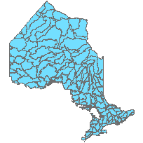
Watershed, TertiaryCoordinate system: 4269 - "NAD83" Abstract:Revision Note: Please note that this dataset has been revised and is available from the Land Information Ontario (LIO) Warehouse. A tertiary watershed is a polygon feature that identifies one of the 147 subdivisions of the secondary watershed divisions which comprise the entire Province of Ontario. A watershed, also known as a catchment basin or area, includes all of the land that is drained by a watercourse and its tributaries. These divisions are based on the federal 'Drainage Area' reporting framework originally known as the Water Resources Index Inventory Filing System (WRIIF). 'The Water Survey of Canada (or, as it was known then, the Department of the Interior, Dominion Water Power Branch) first developed, in 1922, a Water Resources Index Inventory as a convenient and logical system for recording and filing water resources data. It was designed for the storage of such information as the location of waterpower sites, waterpower developments, storage reservoirs, stream measurement stations, and meteorological stations. The Water Survey of Canada delineations involved the division, sub-division and sub-sub-division of Canada into suitably sized areas based on the drainage, for administrative purposes. Although the boundaries are based on drainage, the intent was to include all of Canada's land mass and waters within this drainage area hierarchy to facilitate the identification of hydrometeorological sites. Therefore, the WSC drainage areas do not necessarily define individual river basins, but can represent intervening areas along the coast or include islands.' (National Scale Frameworks HYDROLOGY Version 5.0, NRCan, 2003) ABOUT THIS RELEASE: These boundaries have been created based on the recent Version 2 Provincial DEM and Enhanced Flow Direction products released 2006-2008. The generation of the boundaries also involved some enhanced interpolation and smoothing techniques to produce a final product that is consistent with the current regional hydrology available for Ontario. Watershed naming conventions have also been revised to be more closely in line with Federal names where appropriate. |
Additional Documentation
-
Metadata Information
Language: eng; CANLast Update: 2012-09-26Other Maintenance Requirements:c445f2d3-f92c-47ec-8f59-9afccf2fdd55Metadata Contact:Scholars Portal, Ontario Council of University Libraries Toronto Ontario, CanadaContact Instructions:gis@scholarsportal.infoMetadata Standard:North American Profile of ISO19115:2003 - Geographic Information -
Citation Information
Ontario Ministry of Natural Resources Peterborough Ontario, CanadaThemes or Categories of the Resource: inlandWatersKeywords:Watersheds, Water divisions, Landscape analysis, Water quantity, Water quality, Drainage, Catchments, Watershed Model, Catchment Hydrology, Hydrology, WaterWATER, WATER MANAGEMENT, DRAINAGEWatersheds, Bassin hydrologique, Hydrography, Hydrographie, Drainage basins, Drainage areas, Water, Eau, Landscape management, Water conservation, Conservation de l'eau, Water management, Gestion de l'eauPlace Keywords:Continent > North America > Canada > OntarioPurpose:Watersheds are used in many types of landscape analysis. They are the fundamental unit in which we can understand water in our landscape, including water quantity (flows, levels, etc) and quality (contamination, source protection, etc).Dataset Language:Status: completedUpdate Frequency: asNeededSpatial Representation Type: vectorProcessing Environment:The combination of ESRI ArcGIS 9.1 and 9.2 Workstation and subsequent refinement in Arc Hydro and ArcToolbox were the platforms / tools used to create the data set. The smoothing function employed was the PAEK algorithm at 5 times the spatial resolution of the input raster products. Eg. 10m x 5 = 50m tolerance for Southern Ontario; 20m x 5 = 100m tolerance for Northern Ontario. No smoothing was performed on the Geogratis source layers in the Far North.; Shapefile contained in a SNIF package.ExtentWest Longitude: -95.169552East Longitude: -74.343369North Latitude: 56.859169South Latitude: 41.681320
Supplemental Information: -
Spatial Representation - Vector
Geometric Objects:Object Type: compositeObject Count: 145 -
Reference System Information
-
Data Quality Information
Scope Level: datasetThe horizontal positional accuracy of the boundaries is variable depending on the nature and spatial distribution of the raw DEM information, and thus can not be quantified without onsite investigation and verification. In general, southern Ontario is typically within 100m, and northern Ontario ('near north') is within 400m in the OBM Forestry Area of Undertaking (currently, there is no statistical level of confidence available). The Far North was derived from the Water Survey of Canada's 1:1 Million Fundamental Drainage Areas (FDA) adjusted locally with NTDB 1:250K data for Ontario (Building a Canadian Digital Drainage Area Framework, Brooks et. al., 2002) with an indeterminate level of accuracy. As described in the metadata on the federal Geogratis website, 'These data have been compiled at a scale of 1:1,000,000 with the primary goal being to indicate correct relative positioning with other frameworks layers rather than absolute positional accuracy.' As for the hydrologic network the FDA's are derived from, 'in general, the positional accuracy is within 1300 metres.' (National Scale Frameworks HYDROLOGY Version 5.0, NRCan, 2003).
Process step:Horizontal: Because this is a '4th generation' derived dataset (Derivation Process: Original data based on OBM DTM and/or contours ---> Interpolated to created a DEM ---> Further interpolated to create Enhanced Flow Directions ---> Final Watershed Creation), the level of accuracy declines with each derivation especially in flat or uncontrolled terrain. Therefore, the following statements of accuracy should only be used as a guide. Where the terrain is well defined (eg. hilly terrain), actual accuracy may exceed the stated accuracies. Southern Ontario: +/- 100 m Near North (up to 50 Latitude): +/- 400 m Far North: +/- 1300 m ; Vertical: Not ApplicableCanada Watershed Maps: Geogratis watersheds (federal) were used in northern Ontario where NRVIS data does not exist. These watersheds were seamed together with the NRVIS-based watersheds to complete the province. Data collected from active and discontinued hydrometric stations operated by Water Resources Branch. Data collected from 01/01/1972 to 01/01/2003. The Canada Watershed Maps depicts the primary, secondary, and tertiary drainage basins across Canada.Enhanced Flow Direction grid: NRVIS-based enhanced flow direction grid version 2.1.0/2.1.1 (derived from the Provincial DEMv2). DEM related data collected from OBM and CA information ranging from 01/01/1976 to 31/12/2008. EFD Data collected from 01/01/2004 to 31/12/2008. The enhanced flow direction grid is a derivative from the Provincial DEM, regular Flow Direction grid, water flow and water polygons. Each cell in this grid represents the direction of flow, which is determined by finding the direction of steepest descent from each cell. The flow directions have been 'enhanced' such that the hydrology on the known network is honoured 100 percent with the exception of some shared headwater wetlands and lakes. Where these shared waterbodies exist, the underlying DEM elevation takes precedence to determine the values of the flow directions.Water virtual flow: NRVIS-based water virtual flow The time period includes the collection, creation, and updates made to this data set by CA's and other sources. Data collected from 01/01/1976 to 31/12/2008. The water virtual flow coverage is a line dataset that represents all of the creeks, streams, and rivers in Ontario. These lines are fully connected due to the virtual segments that run through lakes and double-lined rivers. These lines have the correct digitized direction which facilitates upstream and downstream tracing and analysis. -
Distribution Information
Distributor:Ontario Geospatial Data Exchange, Ministry of Natural Resources Peterborough Ontario, Canada -
Related Links