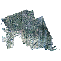
South Central Ontario Orthophotography Project (SCOOP) 2013Coordinate system: 26917 - "NAD83 / UTM zone 17N" Abstract:SCOOP digital imagery was collected with sensor Leica geosystems ADS80 SH82 for areas of Ontario between April 26th and May 7th 2013. The project encompassed an area of approximately 35,762 square kilometers, covering parts of South Central Ontario including Peterborough, Haliburton, Muskoka, Simcoe and surrounding areas. A Leica ADS80 SH82 Digital Camera system including an inertial measuring unit (IMU) and a dual frequency airborne GPS receiver was used for the digital image acquisition. Imagery acquisition was performed at 1,920m AMT (above mean terrain) to produce 20cm GSD RGBNiR orthorectified imagery and related products. Ground control survey was also collected by Fugro. Orthoimagery are available in 1km by 1km coverage tiles in JPG2000 and TIFF image file format. |
Additional Documentation
-
Metadata Information
Language: eng; CANLast Update: 2015-04-27Other Maintenance Requirements:f8f94c8c-4a62-42a0-b1f7-f105c3770b80Metadata Contact:Scholars Portal, Ontario Council of University Libraries Toronto Ontario, CanadaContact Instructions:gis@scholarsportal.infoMetadata Standard:North American Profile of ISO19115:2003 - Geographic Information -
Citation Information
Ontario Ministry of Natural Resources Peterborough Ontario, CanadaFugro Earthdata, Inc. Maryland, United StatesLand Information Ontario (LIO), Ministry of Natural Resources Peterborough Ontario, CanadaThemes or Categories of the Resource: imageryBaseMapsEarthCoverKeywords:Imagery, Orthophotos, Raster, MosaicAerial photography, Photographie aériennePlace Keywords:Continent > North America > Canada > OntarioPurpose:This image data is the result of over 40 private and government entities working together under the guidance of the Ontario Ministry of Natural Resources (OMNR), Land Information Ontario program. The orthophotos will be used for GIS and planning by all funding partners.Dataset Language:Status: completedUpdate Frequency: notPlannedSpatial Representation Type: gridExtentWest Longitude: -80.365222East Longitude: -76.569658North Latitude: 45.725670South Latitude: 43.836588
Supplemental Information: -
Spatial Representation - Grid:
Number of dimensions: 2Axis dimensions properties: -
Reference System Information
-
Data Quality Information
Scope Level: dataset
Process step:The Leica GeoSystems XPro software was used for downloading and preparing imagery collected with the ADS80 Airborne Digital Sensor for soft copy photogrammetric use. The raw image was downloaded in the field with XPro to a portable workstation. This enabled a quick look at image quality and coverage. Using the Leica Geosystems IPAS software package the GPS data was differentially processed against a base station. After the differential GPS solution was checked and verified the Leica Geosystems IPAS program was used to compute an integrated GPS/IMU navigation solution at one-second intervals. Using the GPS/IMU trajectory computed by the Leica Geosystems IPAS software and the camera calibration, XPro computed a full x,y,z, omega,phi,kappa exterior orientation of each scan line. Using the orientation data file produced the L0 imagery was resampled. Theresampling removes most aircraft motion and providesepipolar geometry imagery for stereo viewing, automatedaerotriangulation and automated DEM extraction. TheLevel 1 epipolar-resampled and georeferenced imageryusually will provide a pixel¿s true ground location to within a few pixels without any additional processing. To improve accuracy, a fully automatic aerotriangulation process was performed to minimize the residual errors in the GPS/IMUderived exterior orientations. The aerotriangulation also allowed the introduction of ground control and check points to ensure the accuracy specifications were achieved. Automated aerotriangulation of ADS80 imagery was performed with the Xpro. A digital elevation model (DEM)was required for orthophoto production. DEM was autocorrelated and used to generate the ortho-rectification imagery. The orthorectified imagery was created utilizing Leica Geosystem XPro software. The orthos were mosaiced together using proprietary image database and mosaicing software. The database was edited for seamlines, and other artifacts. The imagery was clipped out of the database into the sheet layout generated based on client use requirements. In the clipping stage, the coordinate system and georeferencing was embedded into the header of the TIFF file. The stereo and orthorectified imagery was QC'ed and delivered on external hard drives. -
Distribution Information
Distributor:Land Information Ontario (LIO), Ministry of Natural Resources Peterborough Ontario, Canada