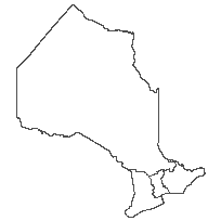
Ontario Public Service (OPS) RegionCoordinate system: 4269 - "NAD83" Abstract:This data set is a polygon coverage that can be used to identify an administrative boundary dividing Ontario into four common upper-level regions based upon upper tier municipal boundaries managed by the Ministry of Municipal Affairs and Housing (MMAH). The Ontario Public Service (OPS) has adopted these boundaries for administrative and functional purposes which will facilitate enterprise initiatives and enhance customer service. Ministries will realign their regional boundaries to these upper level boundaries over time, where and when feasible. |
Additional Documentation
-
Metadata Information
Language: eng; CANLast Update: 2014-03-06Other Maintenance Requirements:de374327-409d-4628-871e-d769491e6bd3Metadata Contact:Scholars Portal, Ontario Council of University Libraries Toronto Ontario, CanadaContact Instructions:gis@scholarsportal.infoMetadata Standard:North American Profile of ISO19115:2003 - Geographic Information -
Citation Information
Ontario Ministry of Natural Resources Peterborough Ontario, CanadaThemes or Categories of the Resource: boundariesKeywords:ADMINISTRATIVE BOUNDARIES, BOUNDARY, ADMINISTRATION, OPS, ONTARIO PUBLIC SERVICE, UPPER TIER MUNICIPAL BOUNDARIES, RABA, REGIONAL ADMINISTRATIVE BOUNDARY ALIGNMENTPUBLIC SERVICESManagement, Gestion, Boundaries, Frontière, Public service, Fonction publiquePlace Keywords:Continent > North America > Canada > OntarioPurpose:Standardized provincial reporting.Dataset Language:Status: completedUpdate Frequency: asNeededSpatial Representation Type: vectorProcessing Environment:GIS Spatial data - ShapefileExtentWest Longitude: -95.153668East Longitude: -74.320109North Latitude: 56.859365South Latitude: 41.676556
Supplemental Information: -
Spatial Representation - Vector
Geometric Objects:Object Type: compositeObject Count: 4 -
Reference System Information
-
Data Quality Information
Scope Level: dataset
Ministry of Municipal Affairs and Housing: Upper Tier Municipalities (MUNICUAD): Upper Tier Municipalities. Data collected on 01/01/2006. Upper Tier Municipality: geographic areas that consist of two or more Lower Tier Municipality. -
Distribution Information
Distributor:Ontario Geospatial Data Exchange, Ministry of Natural Resources (OMNR) Peterborough Ontario, Canada