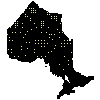
Ontario Base Map (OBM) Digital DataCoordinate system: 4269 - "NAD83" Abstract:This data set is an index identifying Ontario Base Map (OBM) map tiles and digital vector data available for each tile. Eastern and Southern Ontario is covered at a scale of 1:10,000 and Northern Ontario is covered at a scale of 1:20,000. Ontario Base Maps (OBM) are a series of maps created and updated by the Ontario Ministry of Natural Resources between 1977 and 2000. The MNR extracted the 33 layers from their NAD83 NRVIS dataset to create the NAD83 digital OBM sheets and vector data packages. The data provided may not be spatially defined upon download and may need to be defined using GIS (e.g. NAD 83 UTM Zone 18). The data and maps cover most of Ontario and contain many features normally found on topographic maps such as relief, hydrography, vegetation and roads. |
Additional Documentation
-
Metadata Information
Language: eng; CANLast Update: 2013-07-18Other Maintenance Requirements:703ade0d-96bd-4bfa-83c7-dc0f7f3b40c1Metadata Contact:Scholars Portal, Ontario Council of University Libraries Toronto Ontario, CanadaContact Instructions:gis@scholarsportal.infoMetadata Standard:North American Profile of ISO19115:2003 - Geographic Information -
Citation Information
Ontario Ministry of Natural Resources Peterborough Ontario, CanadaThemes or Categories of the Resource: intelligenceMilitaryKeywords:MAPPING, ADMINISTRATION, OBM, OBM INDEX, MAP TILES, REFERENCE GRIDMAPPING, MapsGeographic data, Données géographiques, Cartography, CartographiePlace Keywords:Continent > North America > Canada > OntarioDataset Language:Status: completedUpdate Frequency: asNeededSpatial Representation Type: vectorProcessing Environment:The Natural Resources Values Information System (NRVIS) which is the ministries (Ontario Ministry of Natural Resources) editing environment for provincial datasets.ExtentWest Longitude: -95.292629East Longitude: -74.299215North Latitude: 56.922503South Latitude: 41.675492
Supplemental Information: -
Spatial Representation - Vector
Geometric Objects:Object Type: compositeObject Count: 14709 -
Reference System Information
-
Data Quality Information
Scope Level: dataset -
Distribution Information
Distributor:Ontario Geospatial Data Exchange, Ministry of Natural Resources (OMNR) Peterborough Ontario, Canada