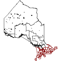
Municipal Boundary - Upper Tier and DistrictCoordinate system: 4269 - "NAD83" Abstract:This layer contains areas of upper-tier and district municipalities in Ontario. An upper-tier municipality means a municipality of which two or more lower-tier municipalities form part for municipalities purposes. Municipal responsibilities set out under the Municipal Act and other Provincial legislation are split between the upper tier and lower tier municipalities. Territorial district means a geographic area in northern Ontario, which is described in the Territorial Division Act and is composed of municipalities, geographic townships, and unsurveyed territory. |
Additional Documentation
-
Metadata Information
Language: eng; CANLast Update: 2013-06-10Other Maintenance Requirements:52900063-3758-421c-a4bb-09b58b08804bMetadata Contact:Scholars Portal, Ontario Council of University Libraries Toronto Ontario, CanadaContact Instructions:gis@scholarsportal.infoMetadata Standard:North American Profile of ISO19115:2003 - Geographic Information -
Citation Information
Ontario Ministry of Natural Resources Peterborough Ontario, CanadaThemes or Categories of the Resource: boundariesKeywords:Municipalities, Municipal boundaries, Upper-tier, DistrictsLocal governments, Administration locale, Municipalities, Municipalité, Management, GestionPlace Keywords:Continent > North America > Canada > OntarioPurpose:To identify the location of Upper Tiers and Territorial Districts.Dataset Language:Status: onGoingUpdate Frequency: annuallySpatial Representation Type: vectorProcessing Environment:Data created using personal geodatabase version 8.3. 1) line feature class created 2) topology created to eliminate topological errors: - lines must not overlap - lines must not intersect - lines must not have dangles - lines must not have pseudos - lines must not intersect or touch interior 3) polygon feature class created from line feature class 4) another topology created on polygon feature class - polygons must not overlap - polygons must not have gaps 5) attributes assigned; Geodatabase.ExtentWest Longitude: -95.156087East Longitude: -74.321072North Latitude: 56.859039South Latitude: 41.676609
Supplemental Information: -
Spatial Representation - Vector
Geometric Objects:Object Type: compositeObject Count: 96 -
Reference System Information
-
Data Quality Information
Scope Level: dataset
Municipal boundaries from paper maps: Some of the data came from municipalities in the form of paper maps, Municipal boundaries obtained from paper maps.Municipal boundaries from digital sources: Some of the data came from municipalities in the form of digital data, Municipal boundaries provided in digital format.Wateredge: MNR water egde coverage. -
Distribution Information
Distributor:Ontario Geospatial Data Exchange, Ministry of Natural Resource (OMNR) Peterborough Ontario, Canada