Aquatic Resource Area Survey PointCoordinate system: 4269 - "NAD83" Abstract:This data set is a point coverage that can be used to indentify the physical characteristics and fish species that pertain to one survey location on a waterbody (lake, river, or stream). Each survey is characterized by a single point location with associated attributes, and may be representative of a portion of a water body or an entire waterbody (lake, river, or stream). The information in Aquatic Resource Area (ARA) Survey Point is used to update the ARA Summary layer. Every ARA Survey Point must be associated with an ARA Summary record. The ARA Summary and ARA Survey Point layers are linked through the use of the 'ARA Identifier' attribute. ARA Summary is available for download from the Portal via the following record: Supplementary tables can be used and are available for download from the additional documentation section. |
Additional Documentation
-
Metadata Information
Language: eng; CANLast Update: 2013-11-04Other Maintenance Requirements:81c00843-921b-4cc1-a4f0-46abd9bedf57Metadata Contact:Scholars Portal, Ontario Council of University Libraries Toronto Ontario, CanadaContact Instructions:gis@scholarsportal.infoMetadata Standard:North American Profile of ISO19115:2003 - Geographic Information -
Citation Information
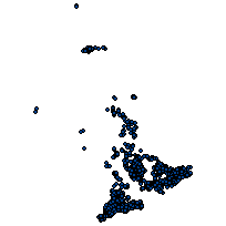
Ontario Ministry of Natural Resources Peterborough Ontario, CanadaThemes or Categories of the Resource: biotaKeywords:FISH, FISHES, FISHERIES MANAGEMENT, FISHERIES, AQUATIC RESOURCE AREA, WATER, AQUATIC ECOLOGY, STREAMS, LAKES, TEMPERATURE, AQUATIC RESOURCE SURVEY, AQUATIC SURVEY, ARA SUMMARY, AQUATIC RESOURCE AREA SUMMARYFishes (Pisces), FISHERIES, FISHERIES MANAGEMENT, AQUATIC ECOSYSTEMS, WATER, STREAMS, RIVERS, LAKES, TEMPERATUREWater, Eau, Fish, Poisson, Fisheries, Pêcheries, Fisheries management, Gestion des pêches, Aquatic ecosystems, Écosystème aquatique, Rivers, Cours d'eau, Lakes, Lac, Temperature, TempératurePlace Keywords:Continent > North America > Canada > OntarioPurpose:The Aquatic Resource Area (ARA) data classes are the authoritative source of generic fisheries spatial data in Ontario. The Aquatic Resource Area data classes provide fisheries information for fisheries management, municipal planning, forest management planning, natural heritage and other land use planning, issuance of work permits under the Public Lands Act, issuance of licenses under the Fish and Wildlife Conservation Act, and fulfillment of public information requests.Dataset Language:Status: onGoingUpdate Frequency: asNeededSpatial Representation Type: vectorExtentWest Longitude: -88.986852East Longitude: -74.368306North Latitude: 55.244311South Latitude: 41.995864
Supplemental Information: -
Spatial Representation - Vector
Geometric Objects:Object Type: pointObject Count: 7978 -
Reference System Information
-
Data Quality Information
Scope Level: series -
Distribution Information
Distributor:Ontario Geospatial Data Exchange, Ministry of Natural Resources (OMNR) Peterborough Ontario, Canada